West Maui Loop
WMC Team
The West Maui Loop is one of a Trio of Bucket List rides here on the Island of Maui. The Haleakala Crater climb and the Hana Highway out and back complete this Trio. Here I will be describing the West Maui Loop in some detail. Read, then ride and enjoy! Aloha.
This West Maui Loop (WML) begins for West Maui Cycles (WMC). Most of the roads and highways on Maui are marked with small green mile markers (mm). Most of these are accurate, but some are way off. I will use the highway names and not the highway designated numbers; it’s easier for us islanders.
WMC is located at mm 21.5 on Honoapiilani hwy (30) in the towne of Lahaina. Honoapiilani hwy has a wide shoulder from the Towne of Wailuku (mm0) to mm31.
Leaving the shop and heading North (towards Kapalua) you will have numerous traffic lights and intersections until you get to mm29 (Napilihau St)This is a great place to get coffee; try the ‘Peaberry’ it’s may favorite! You will be climbing for the mile to mm30 at the top of Kapalua (office road across the street) the elevation is about 300ft. Now you descend to mm31 where the shoulder narrows and the traffic lessons- unless the surf is up!

This is possibly the rainy section of the ride.
Note of Caution:
Here the road becomes quite rural and narrow. There’s not much pavement to the right of the white line and the two-way traffic is divided only by a double or single yellow line. From this point to Wailuku please be mindful of local traffic and respect that the residents do have places to go like school and work. Ride as far to the right as is safe and wave traffic by when possible. RESPECT all traffic laws, stop signs and lights! Bicycles riders are vulnerable on the roadways. We want to encourage mutual respect that will keep us a little safer. Smile, Shaka and show your Aloha!

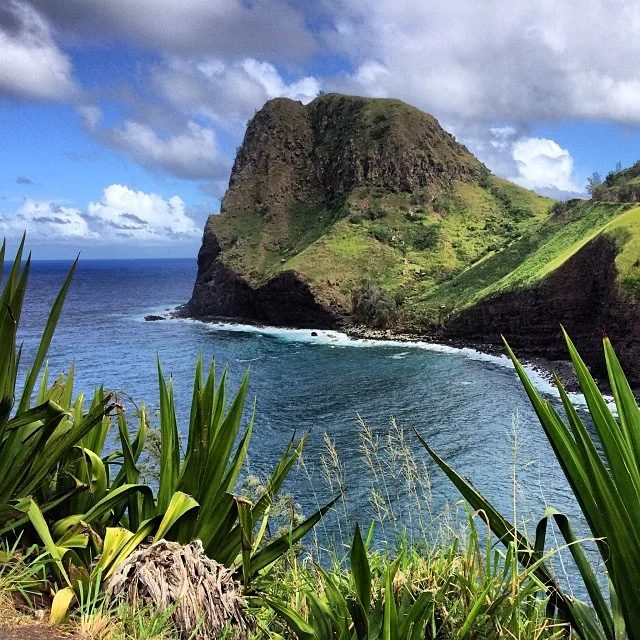
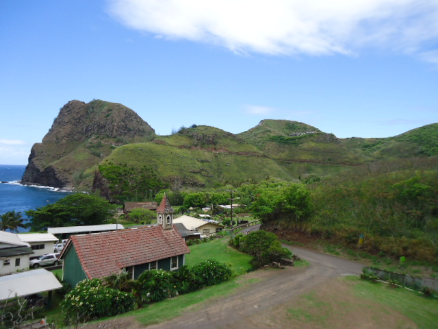
As you wind past outrageous ocean and coastal views you will pass the World famous Honolua Bay (mm33-34) This bay has some of the best and most sought after waves for surfing Worldwide. Winter surf is better at this spot and there are a few turnouts for safe viewing.

The next highlight, depending on one’s point of view or your love of climbing, is “The Wall” (mm36.5) or as our Canadian friends have dubbed it “Mr Steepy”. This is the steepest climb on the entire WML with an average of 16% and a high of 19%; it is less that ¼ of a mile long. You round the corner at 220ft of elevation. If you are riding at a snail’s pace, it’s only two minutes of your life. I guess the fastest time is around a minute- I’m sure this was achieved by a genetically superior human or a rider who has no pain receptors. After the right turn at the top you get a couple of hundred yards to breathe before the next short and steep 100ft vertical climb, then rest for 1.5 mile of rolling hills.

The Wall

Often after night time rains the hillsides wash onto the roads, leaving a very slick thin layer of Maui clay. Use caution.
Nakelele Point is the most Northerly point of land on Maui and the Blowhole is just past mm38.

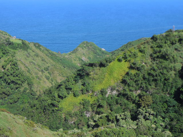
Now you are in for 12 miles of interval style riding and relentless climbing and descending. Be careful at the bottom of the descents. You will notice lots of dust and dirt in the turns on a dry day, be cautious! Be extra careful when it has rained; our dirt is clay based and so is very slippery when wet!!
The mile markers change direction after mm42. The road changes from Honoapiilani hwy to Kahekili hwy. You will see mm16 after mm42 (if it’s still there). Funny, mm42 gets run over all the time; it’s on the outside of a bottom lower left hand turn and it’s not there more than it is.
About mm15 you will see a giant 8ft round rock on the mountain side of the road. They call this ‘Bell Rock’ It’s said that if you put your ear to it and tap or rub the rock with a small stone you can hear it ring. Just ahead of here the road narrows to ONE, 7-10ft wide, lane. You are entering the Kahakuloa area. This one lane road lasts for about 2 miles through the fishing village of Kahakuloa (mm13). There are a few places to get water and snacks, the two most talked about are Lorraine’s and Julia’s. Lorraine was mentioned in an earlier blog, she has tubes and other emergency things. You will cross a metal bridge at the bottom of the valley-extremely slippery when wet. Now you encounter a steady and beautiful climb out of Kahakuloa.

Bell rock at mm16

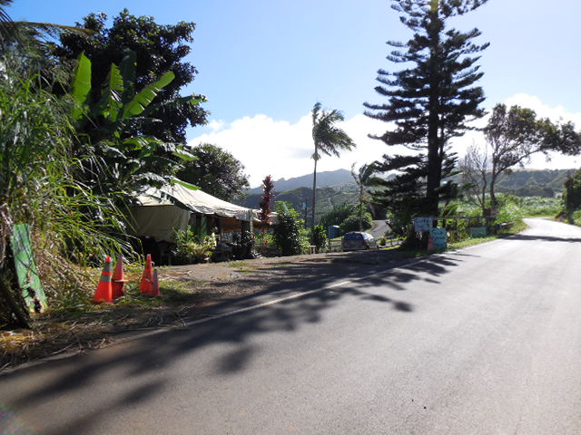
Lorraine's Shave Ice- a great place to stop for bicycle repair stuff and great snacks.

Between Lorraine's and Julia's you will find the Kahakuloa Bridge, famous for taking out cyclists when wet.
A big yellow house at the top of the top of the first part of the climb (about a mile) has a gallery that sells Hawaiian crafts and more snacks! Stop in and say Aloha to the ladies. They always have big smiles and the coldest drinks in the fridge by the front door. Just across from the gallery is Kahaloa head, a major landmark in the area.

Kaukini Gallery
Leaving the gallery you will climb for about another mile, then the last big rollers will be ahead of you. Just past mm10 you will find the famous ‘Turnbull Gallery’ with a wooden giraffe on the ocean side of the road. You can get more food and water 300 yards later at ‘Curly’s fruit stand. Mile Marker 9 is the highest elevation on the loop (about 950ft) You are now on the back side of this ride.
Curleys' fruit stand
Prepare for Mini rollers to mm7 and then a two mile decent to the bridge at mm5. Be careful at this point as there tends to be a lot of dust and debris on the mountain side of the decent.

sights along the way!
Contrary to most maps, Kahekili hwy does not end into Waiehu. Do not make a left at Waiehu Beach rd. At mm3 continue to follow the double yellow line fading to the right. You will encounter a slight climb into the towne of Wailuku. Don’t make any major turns once you reach the first set of businesses, you will know you’re still on the right road when you see Takamiya market on the right. The roadway is narrow with heavy traffic in this area. Stay alert.

Just up the hill from Takamiya market you will encounter a stop sign; across the street you will see a ‘Do Not Enter’ sign. This is the intersection of Market Street and Vineyard st. Take a right on Vineyard. Take a left at the second street, this will be High street. About a 100 yrds ahead is the intersection of Main St. and Hononapiilani hwy (mm0) Straight through the intersection and 21.5 miles later you will be back at West Maui Cycles.

take a right at Vinyard street, up the hill two blocks, take a left on High street. Honoa'piilani Highway 21 miles back to the shop.

kahakuloa
You will have traveled 58 miles with a vertical gain of about 3800ft. You have done ‘The Loop’ as we call it. Congrats!
I have been doing this ride for 23 years. The first time was an adventure. I had no information about this ride except for a map. Having done it so many times, I now know it very well. My girlfriend calls me Maui’s Human GPS. When I first did this ride all those years ago there were less than 5 stop light, no there are 25! Progress? Who knows!
For the past year the County and the State have been repaving the road from mm35-mm42 and mm16 to mm7, it is now PERFECT!

I am partial to an out-and-back travelling from Lahaina and enjoy this shorter ride often. A great turn around point is Kahakuloa (mm13) on short days and Waihee golf course (mm4) on long ride days. The turn-around at Waihee will get you an extra 2700ft of climbing for that day- so about 6000ft total!

Waihee School is at mm4, great place to get water and turn around.
Now the big question! Which direction is best to do the Loop? Some base the decision on wind direction and some base it one getting the climbing out of the way early on in the ride. Clockwise from a Lahaina start gets the climb over combined with a downwind (tradewind days) rest from Wailuku to Maalea this seems to be the most popular. I personally like to do the Loop counter-clockwise. I like to be on the Oceanside of the roadway. It can be a bit scary at points, but the views are spectacular-lots of valley view’s down to the water. The winds (tradewind days) are not too bad from Maalea to Wailuku. Usually when you get to mm4 by the Kahili Golf course the trees break the wind.